Vision
Vision is a collaborative mission support system designed to enhance coordination and tactical awareness during wildfire response operations.
COLLABORATION
TYPE
Software and hardware
Defense
When a wildfire doubles in size every 30 minutes, coordination can't wait for the radio to clear.
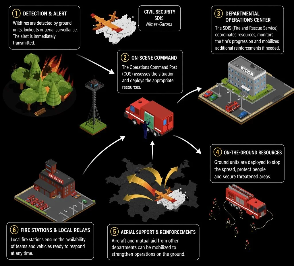
The French Response EcosystemSix actors.
Six vantage points.
One fire.
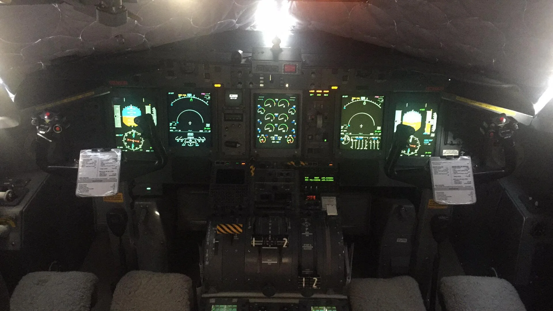
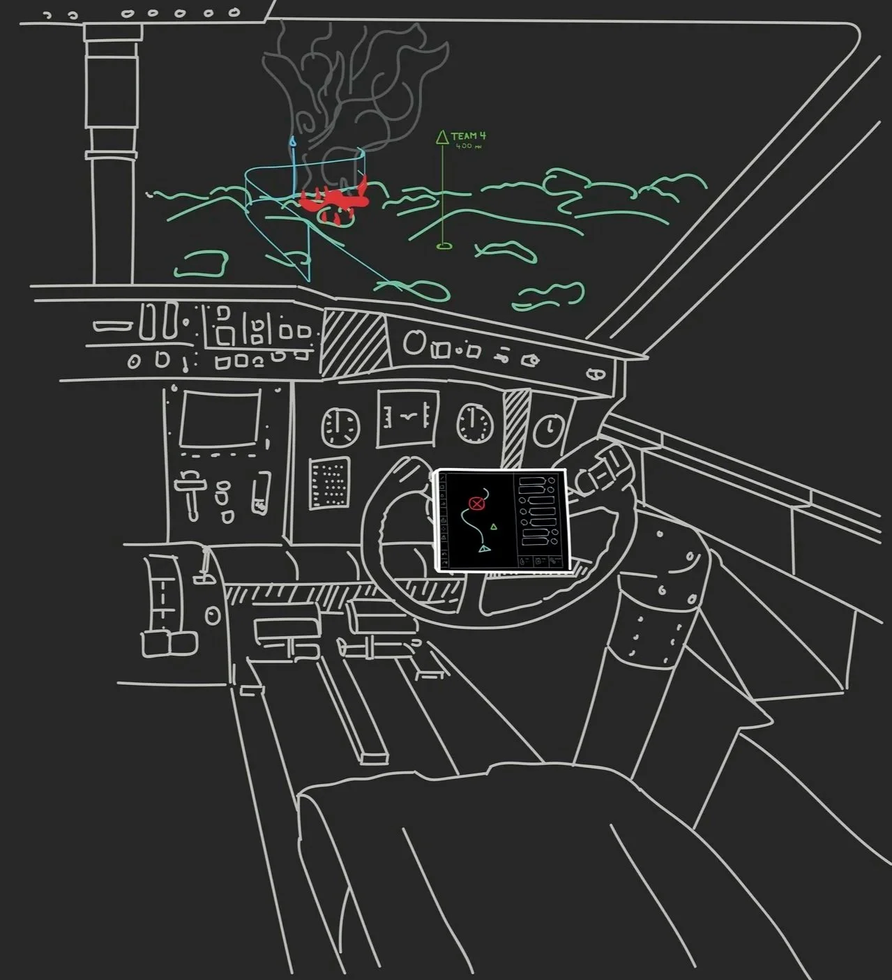
A pilot sees the fire as a moving shape in a landscape, through a cockpit wide-angle. A ground crew member sees smoke, a firebreak, a neighbor’s barn. The departmental command center sees weather fronts and resource flows.
There is no shared picture. Just voices on a radio, trying to translate what each one is looking at.
THREE FAILURE MODESWhere coordination breaks.
01
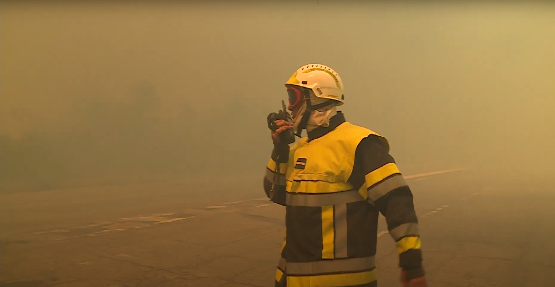
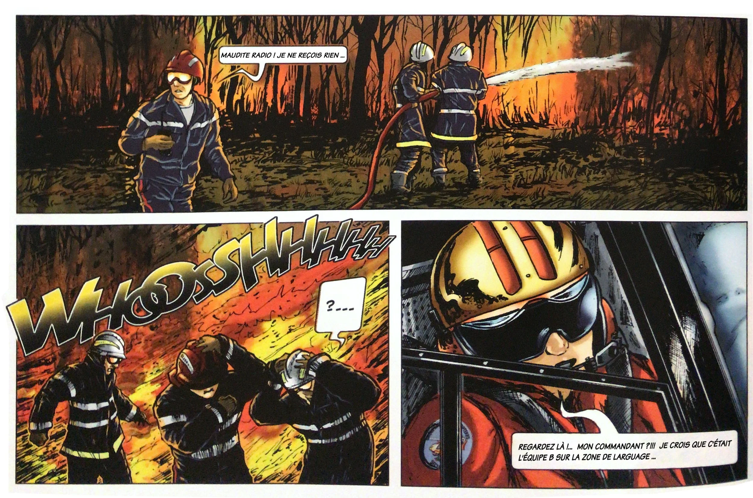
Radio is unreliable. And radio is all they have.
"There are often radio communication problems. We lose reception, and it creates a considerable workload."
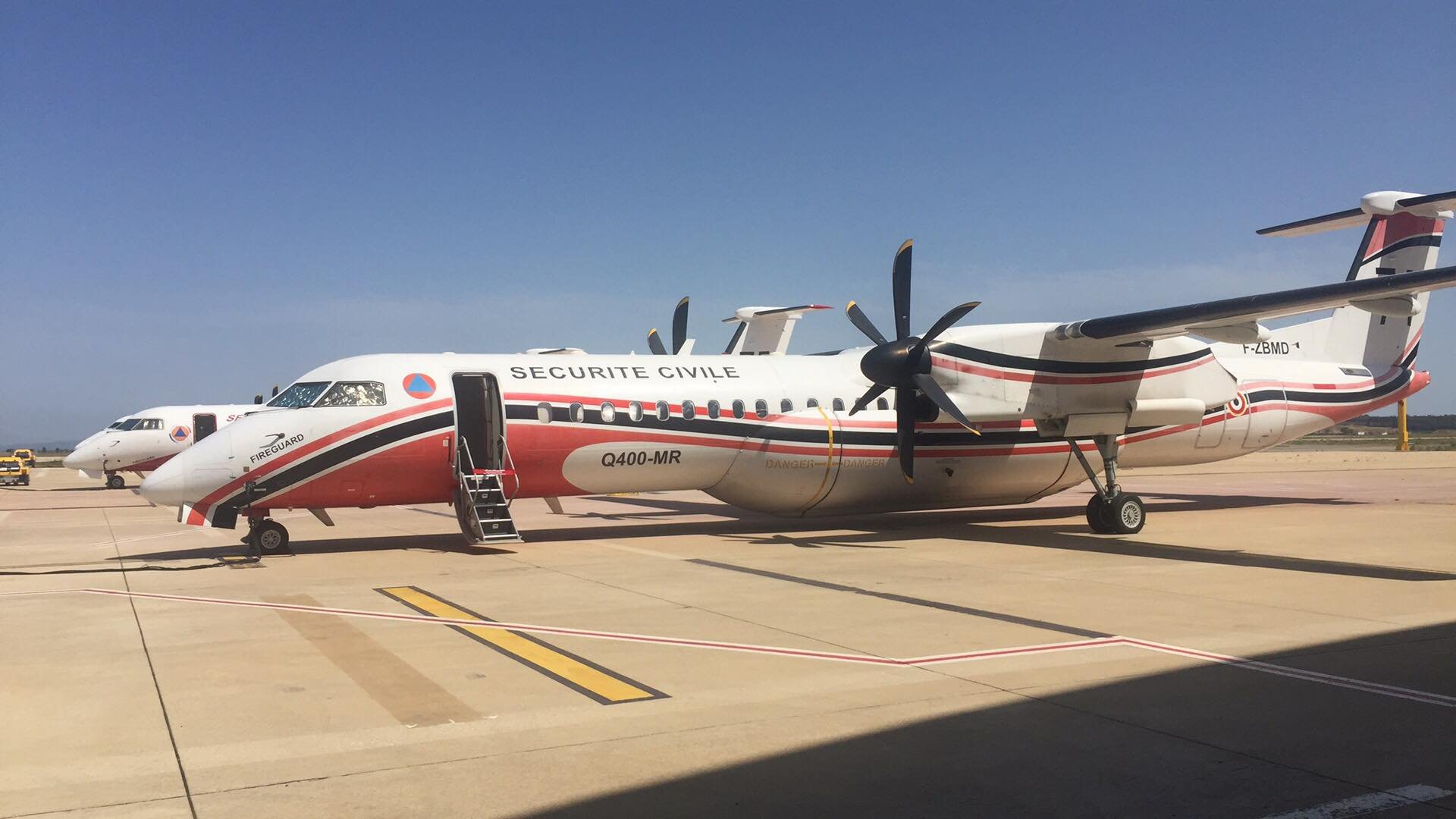
BASTIEN — DASH PILOT · SÉCURITÉ CIVILECommunication between teams is primarily done via radio, often with poor reception and limited to verbal exchanges. In high-stress environments, this can lead to misunderstandings, delayed coordination, and information loss, especially when multiple actors are involved in dynamic and fast-changing situations.
03
Lack of shared operational reference.
"There are often radio communication problems. We lose reception, and it creates a considerable workload."
BASTIEN — DASH PILOT · SÉCURITÉ CIVILEDifferent actors operate with different frames of reference. A pilot in a Canadair or Dash aircraft sees the landscape from a high-altitude, wide-angle view, while a ground crew member perceives the terrain at a very granular, local level. Without a common situational picture, aligning decisions and actions becomes difficult, often requiring manual verbal translation of spatial cues.
02
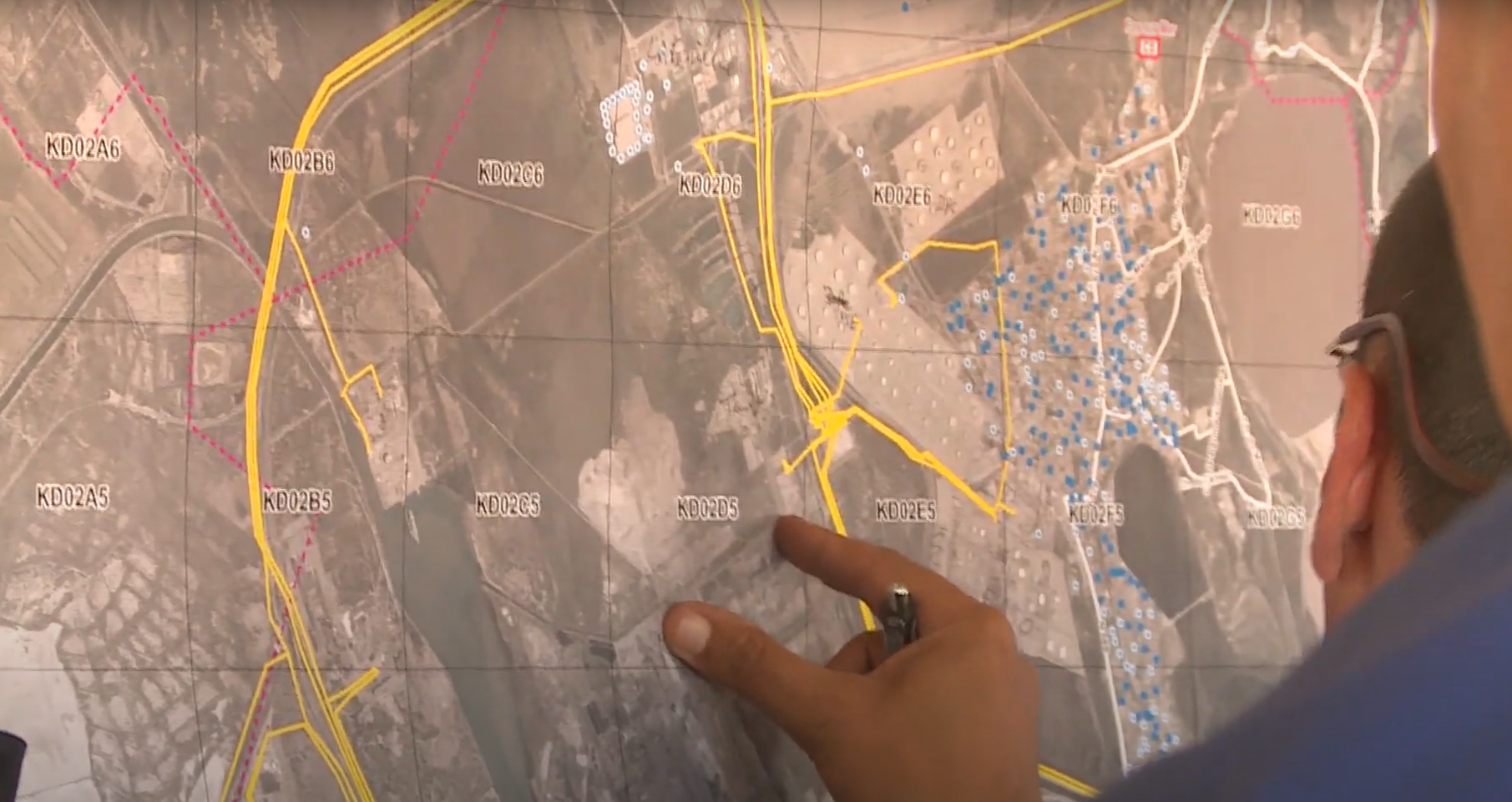
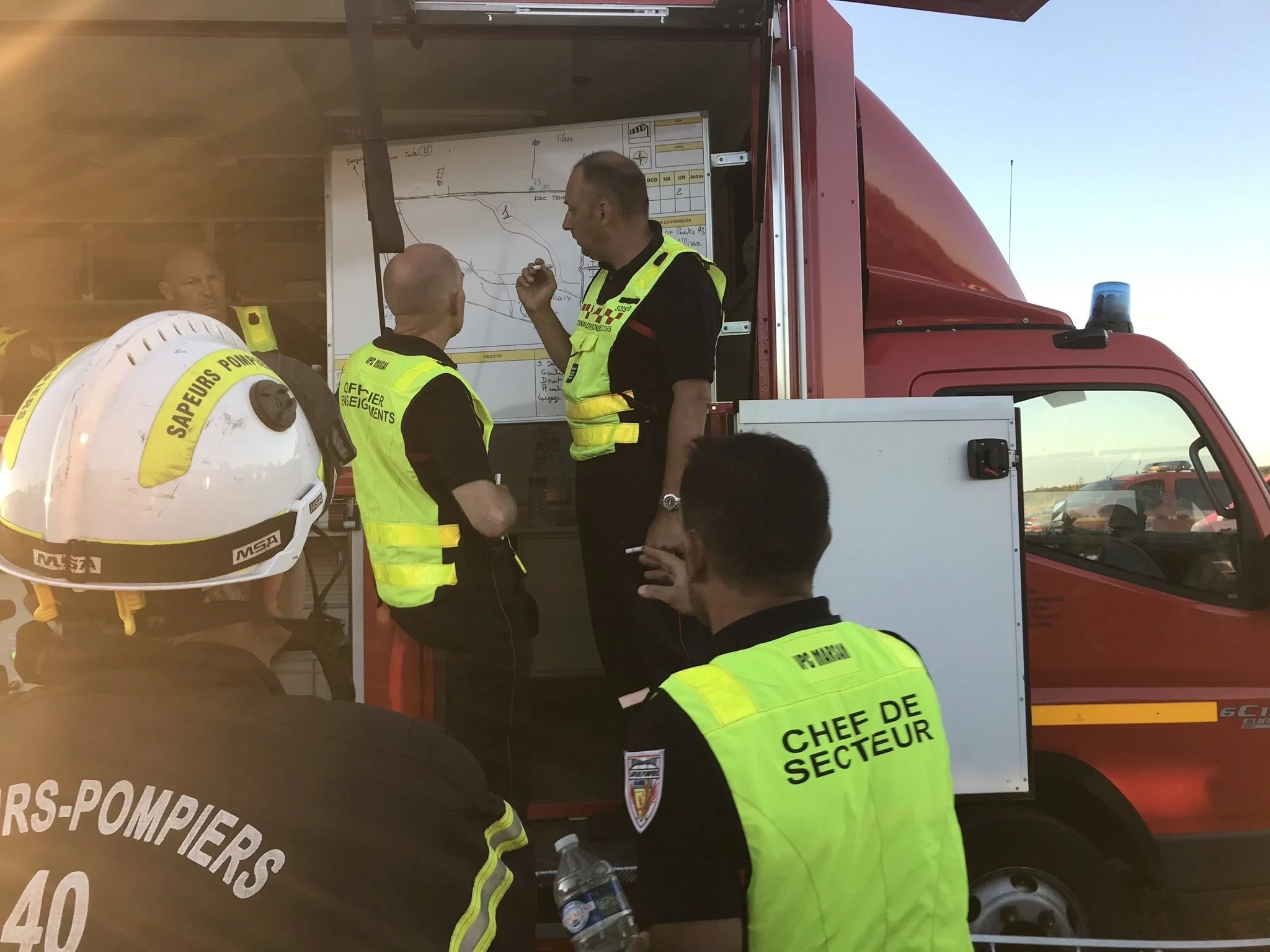
Mission planning still runs on paper.
"There are often radio communication problems. We lose reception, and it creates a considerable workload."
BASTIEN — DASH PILOT · SÉCURITÉ CIVILEMission planning is still largely based on paper maps with mission-specific graphic codes. These tools are static, non-interactive, and not updated in real time. They don’t integrate critical changes such as evolving weather conditions, fire spread, or updated priorities, which limits situational adaptability and slows down decision-making.
How can we improve tactical situation awareness and support coordination between ground and aerial operators during wildfire response operations?
The design question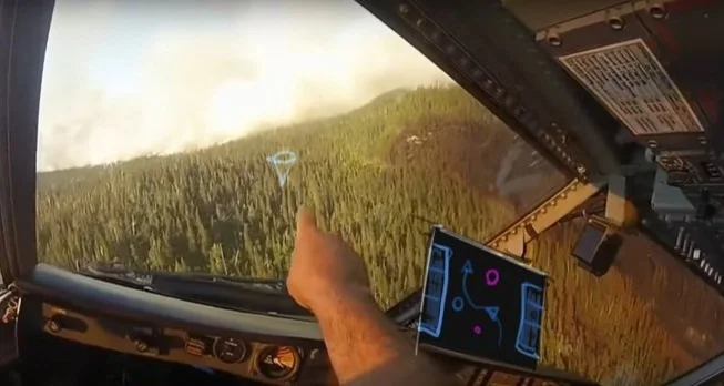
The solution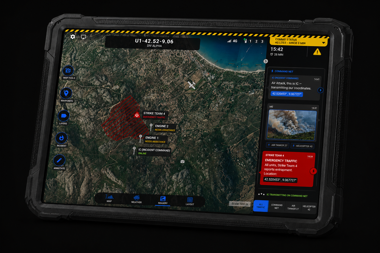
Vision is a collaborative tactical solution designed to support coordination during high-intensity wildfire operations. It connects ground and aerial teams through a shared digital interface, enhancing situational awareness, decision-making, and communication in the field.
It combines:
A collaborative map-based software
Connected objects (radio/audio capture modules)
A robust embedded system tailored to field constraints
🌟 Core Value Promises
Supports change management in field operations
All-in-one service: hardware, software & after-sales support
Plug-and-play deployment
Rugged and field-ready for extreme conditions
🔥 Designed for field realities
〰️
UI made for decision-making
〰️
🔥 Designed for field realities 〰️ UI made for decision-making 〰️
⚙️ How It Works
With a robust communication system
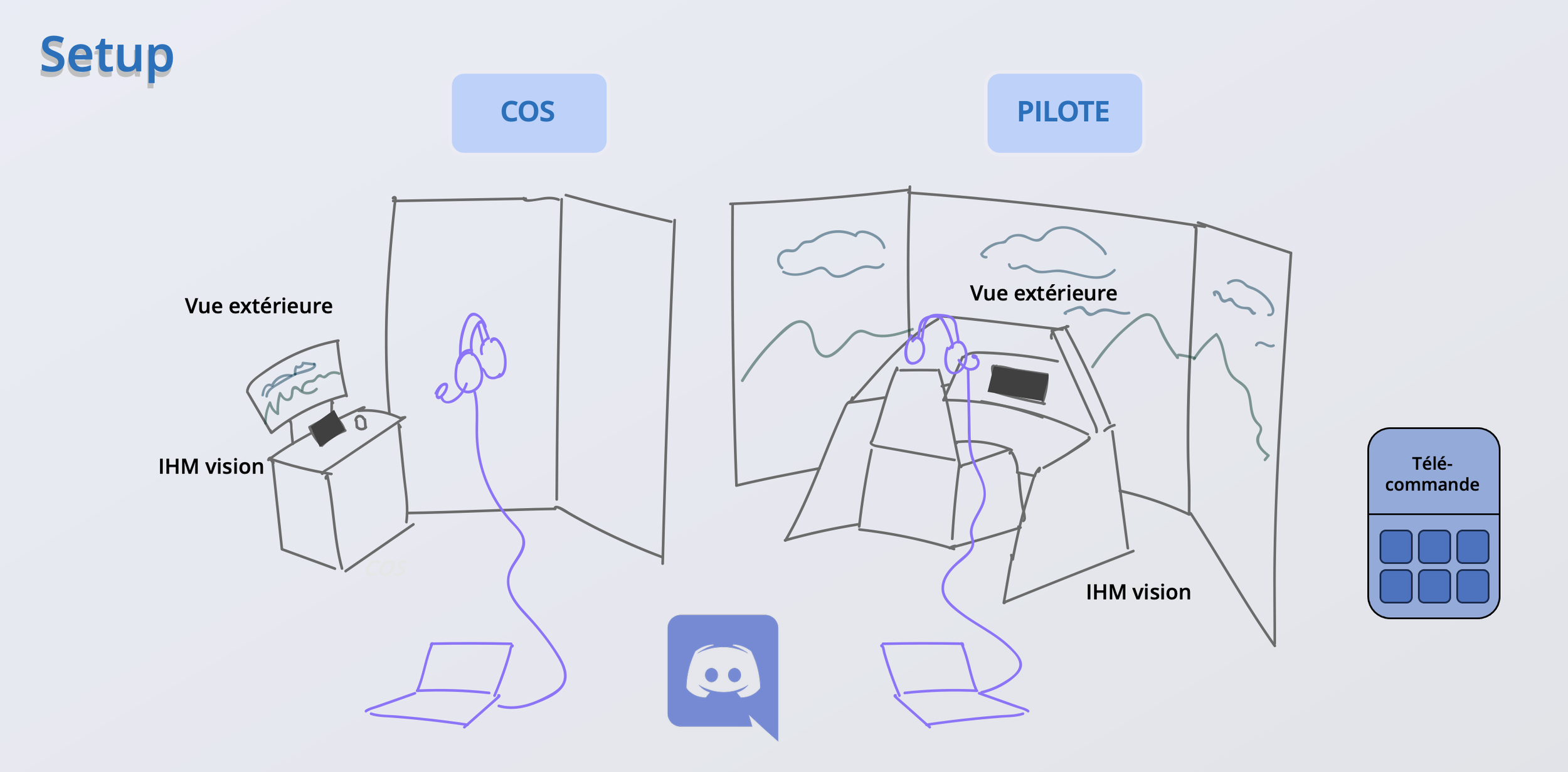
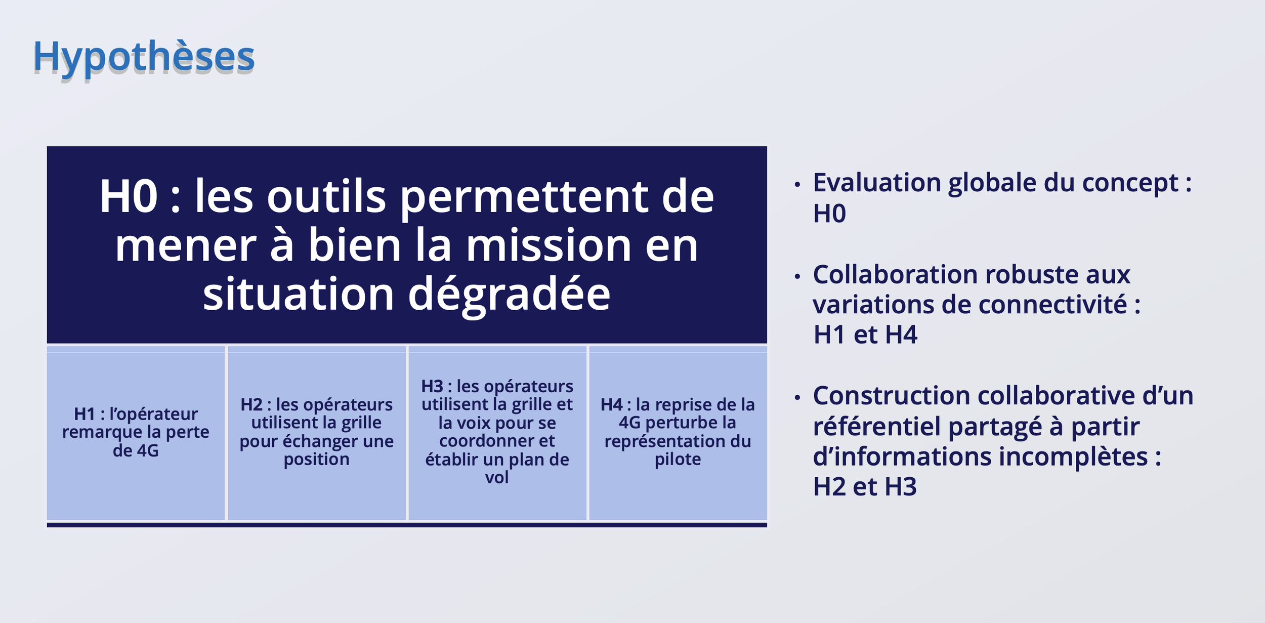
In the middle of a high-stakes aerial firefighting mission, two operators need to stay perfectly synchronized:
Operator A, the ground coordinator (COS), and Operator B, the helicopter pilot.
Each of them is equipped with a rugged tablet interface, designed for critical operations. These tablets are connected via the jack or lightning port to a radio communication module, a certified, secure device that bridges into the official firefighting radio network.
The voice messages received through the radio are processed in real time using Nuance’s voice recognition engine. Transcriptions are displayed directly in a chatbox within the UI and, when geolocation data is included, they are also pinned on the map, ensuring that no information is missed, even in noisy or high-stress environments.
But voice isn’t the only channel.
When network coverage allows it, the system also leverages cellular connectivity (3G/4G/5G) to enable data-rich exchanges between ground and air: shared maps, mission updates, alerts, and silent coordination messages are transmitted seamlessly.
The result?
A robust, multi-layer communication system that adapts to the context, ensuring operational continuity whether you're in radio-only zones or connected airspace.
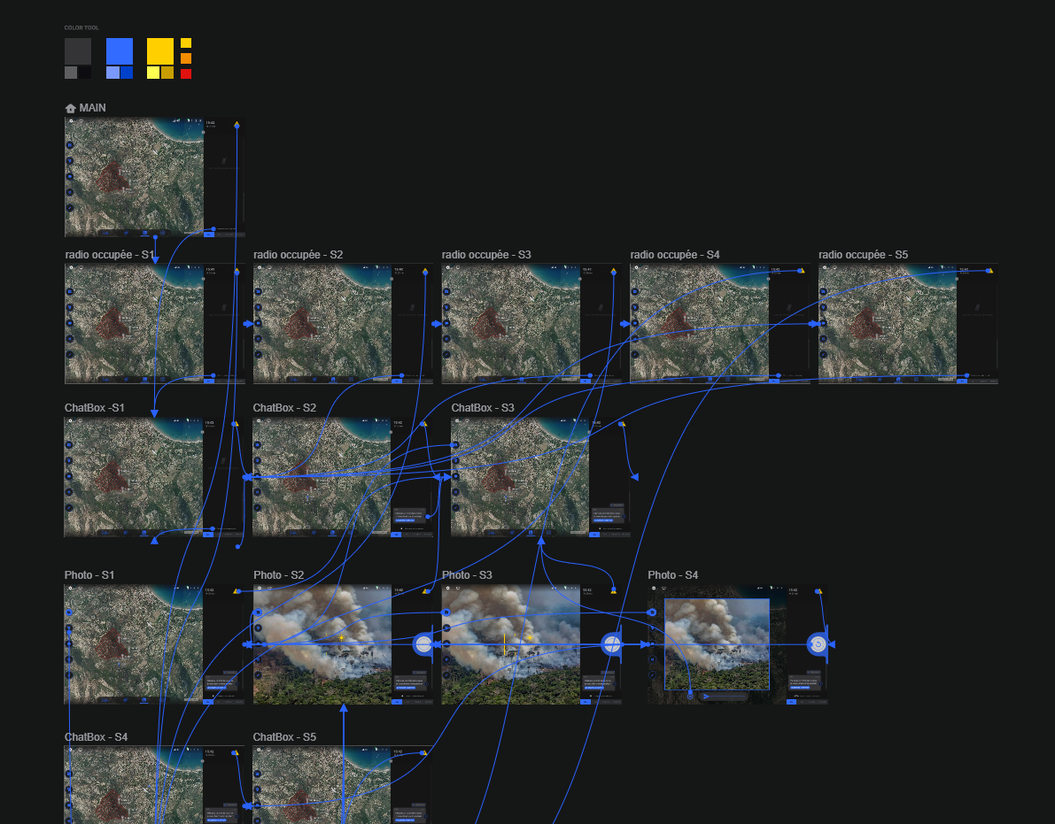
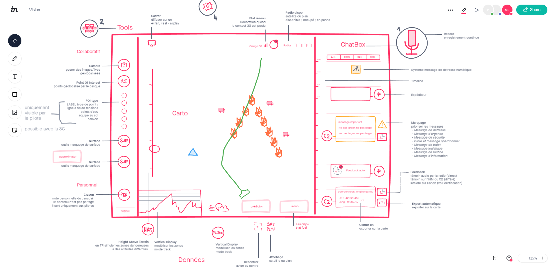
The Interface
💬 Chatbox
The chatbox is a communication interface that transcribes incoming radio messages into written text, improving clarity and ensuring traceability during operations. It also allows users to send photos and Points of Interest (POIs) directly through the interface.
📶 Connectivity Monitor
This feature lets users switch between 3G, 4G, 5G, or radio networks based on coverage. In case of connectivity loss or degradation, the system issues alerts and suggests fallback options. Key interface elements display network quality indicators, helping users assess connection reliability before sending data or alerts reducing the risk of communication failure in the field.
🗺️ Grid
The grid feature overlays a geospatial reference system on the map, helping users segment large operational zones into smaller, manageable areas. By selecting a grid cell, users can easily report events, assign missions, or describe positions with accuracy even when GPS coordinates are unavailable or radio clarity is poor.
🔔 Quick Alert Function
This interface feature allows users to send predefined emergency messages in just a few taps a crucial time-saving mechanism in high-stakes, time-critical situations.
UX Process
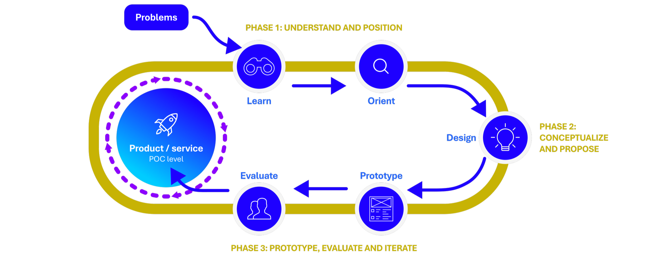
Phase 1: understand and position
Phase 1: understand and position
Learn
Field Research – Understanding the Operational Ecosystem
-
To map out the ecosystem and identify stakeholders, I launched an exploratory survey targeting firefighter communities involved in forest fire operations. The survey introduced the project’s design approach and gathered insights on current pain points. It also helped me establish direct contact with field professionals willing to share their experience.
-
I conducted in-depth interviews with 10 professionals representing a wide range of roles and responsibilities within the wildfire response ecosystem:
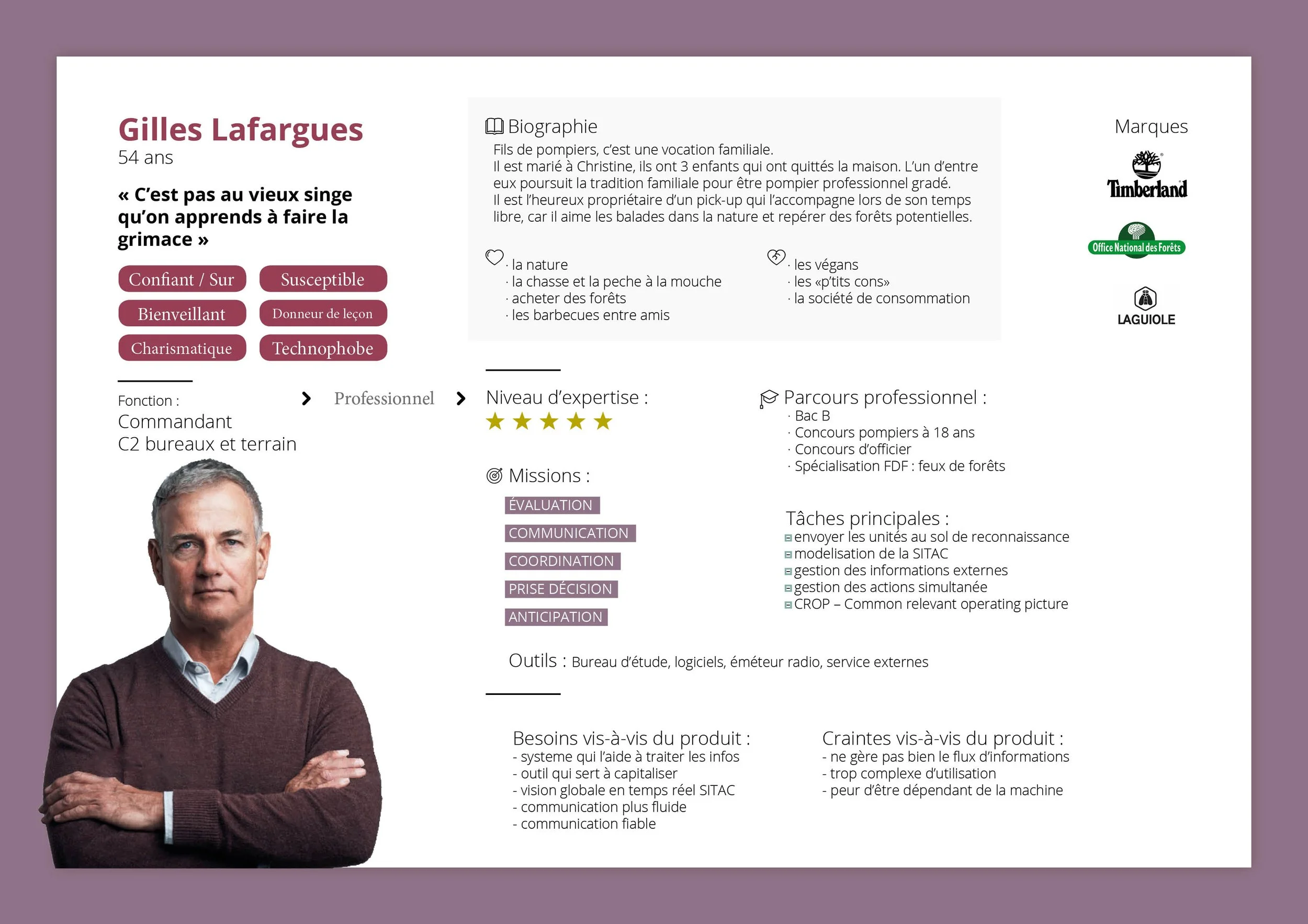
A commanding officer from SDIS 40 (local firefighting unit),
Two forest landowners,
An agent from the National Forest Office (ONF),
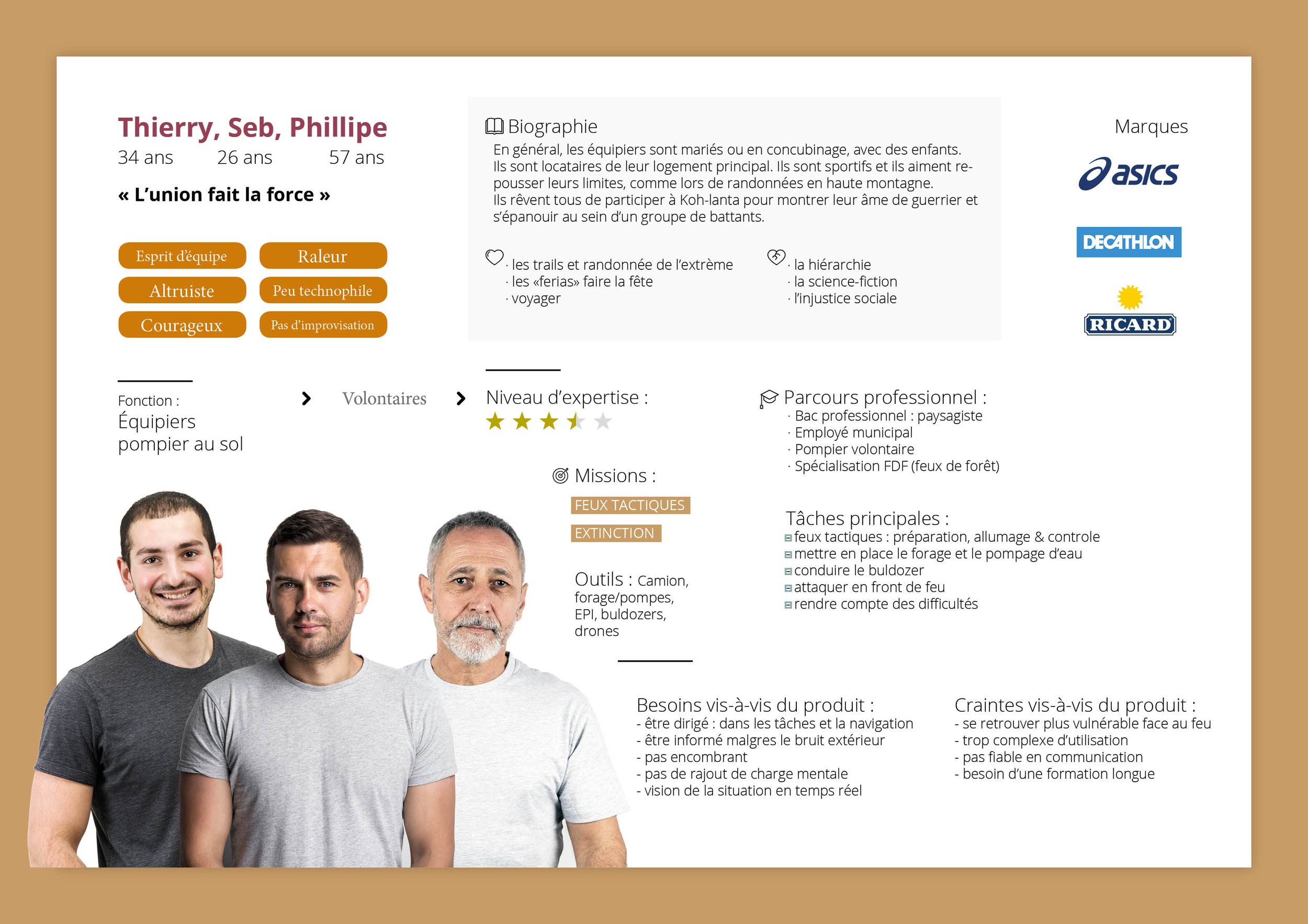
Two aerial firefighters (pilots of Dash and Canadair aircraft),
A ground firefighter,
An innovation officer at the SDIS, responsible for funding and new technologies,
A firefighter in charge of alert and incident detection systems,
And a firefighter responsible for threat mapping and cartographic risk representation.
These interviews provided rich, multifaceted perspectives on operational constraints, inter-agency coordination, and emerging technological needs.
-
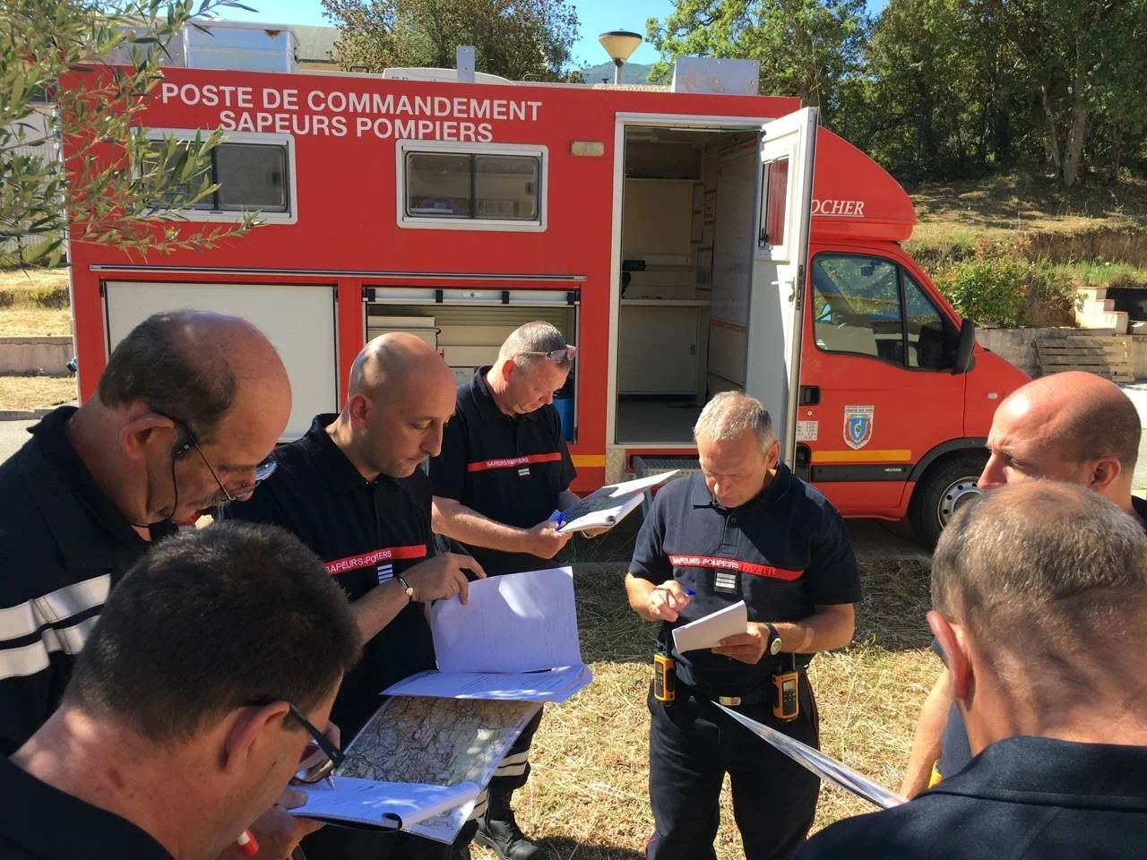
I spent a full day embedded at the wildfire command center, observing how teams operate in real-life conditions. I explored the workflows, communication practices, and technical tools they use to manage incidents. This immersive experience allowed me to listen to on-the-ground needs, observe tactical decision-making in context, and grasp the operational nuances that can’t be captured through interviews alone.
Define what I’ve learn from research and orient your positionning

Orient
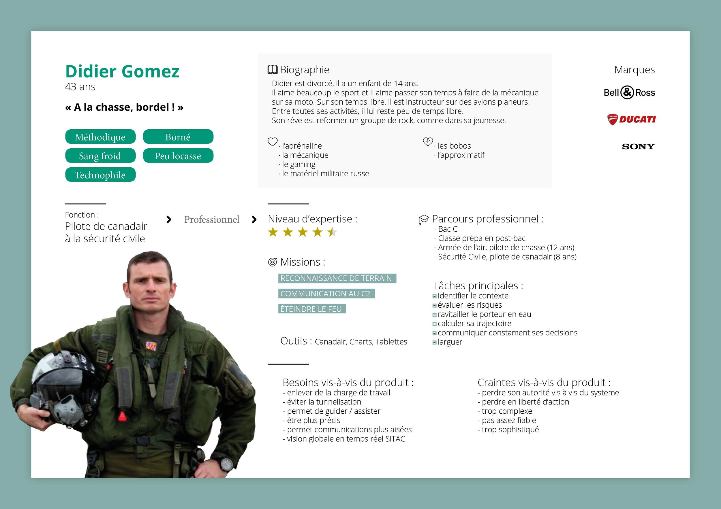
Pilot persona→
Ground firefighter persona →
Commandant persona →
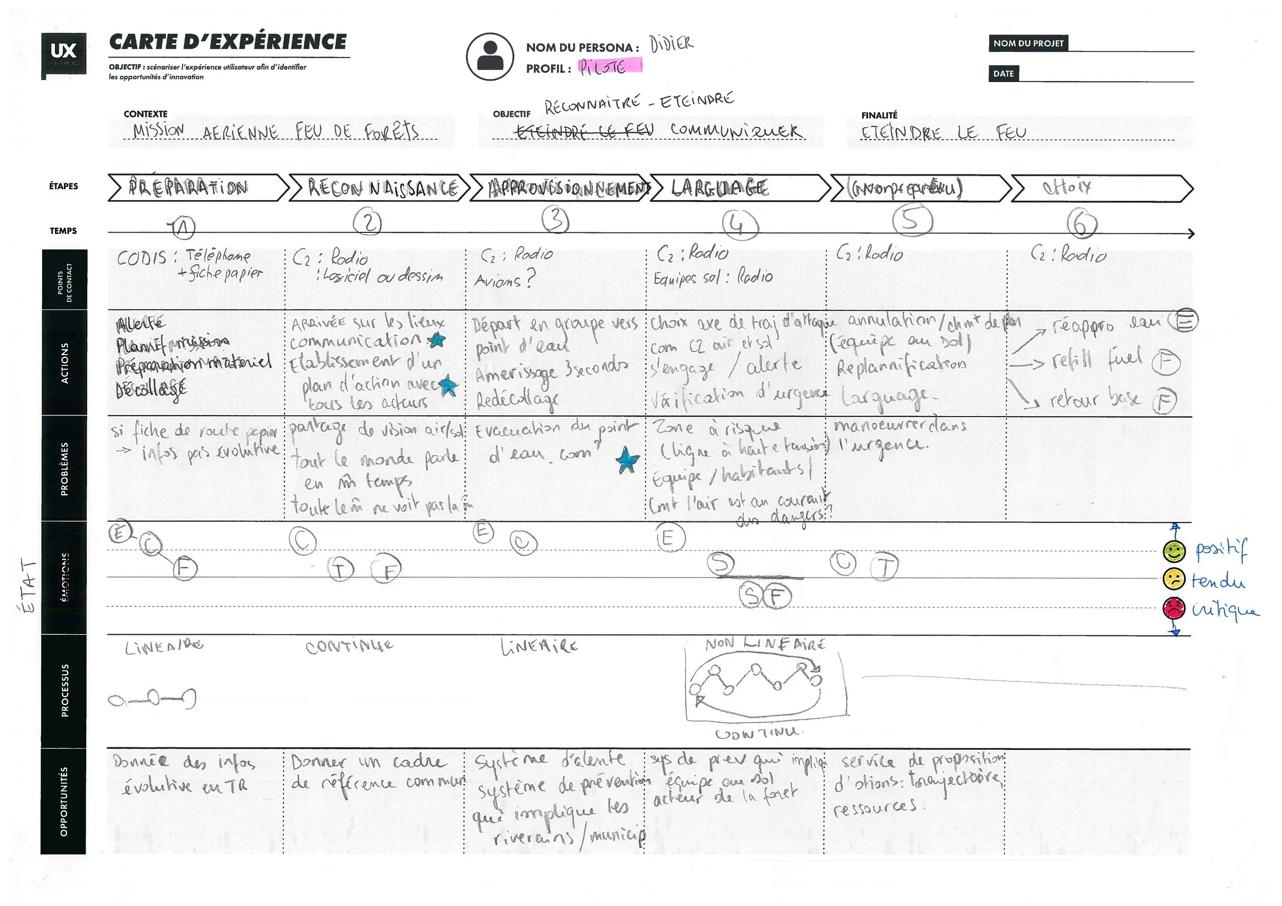
Commandant user journey →
Phase 2: Conceptualize and propose
Phase 2: Conceptualize and propose
Design
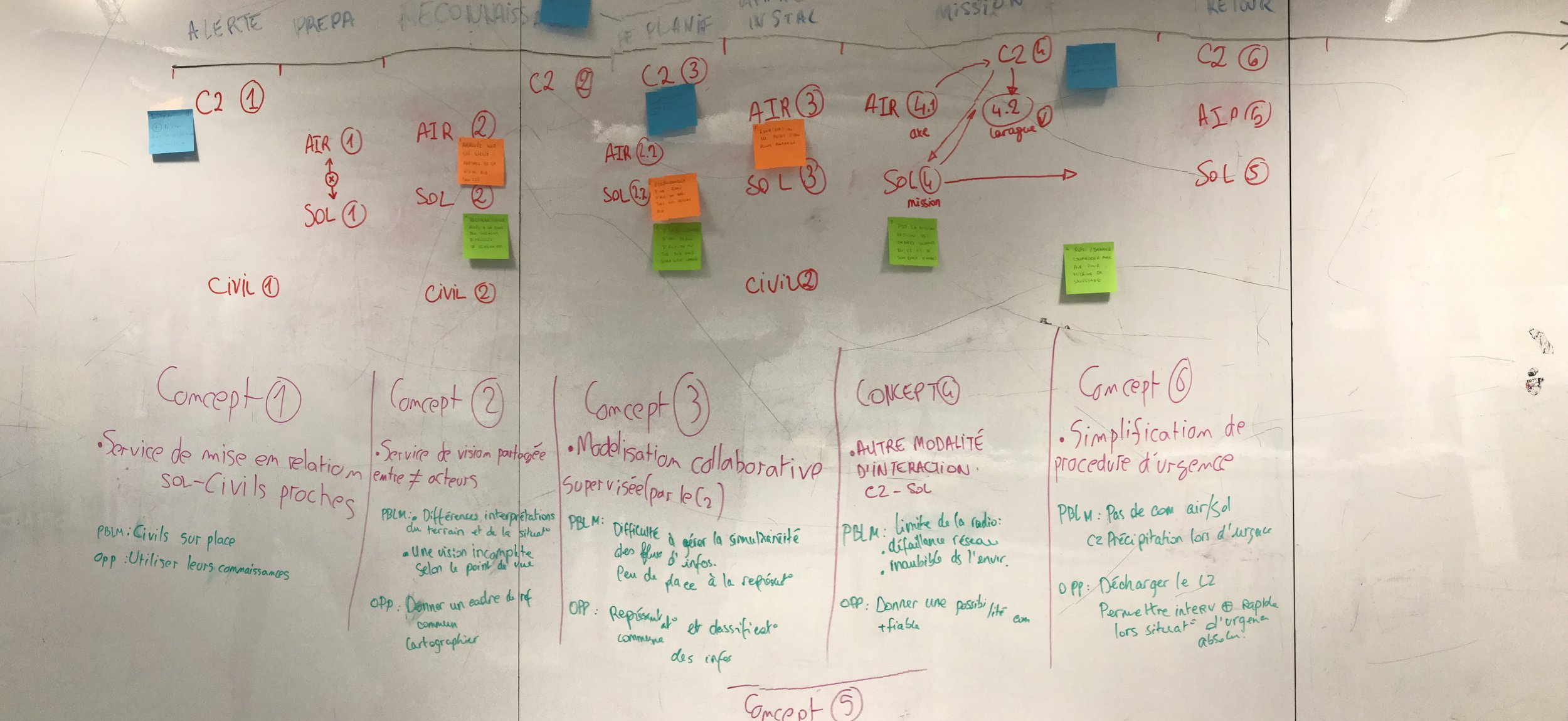
Ideation – Exploring early concepts
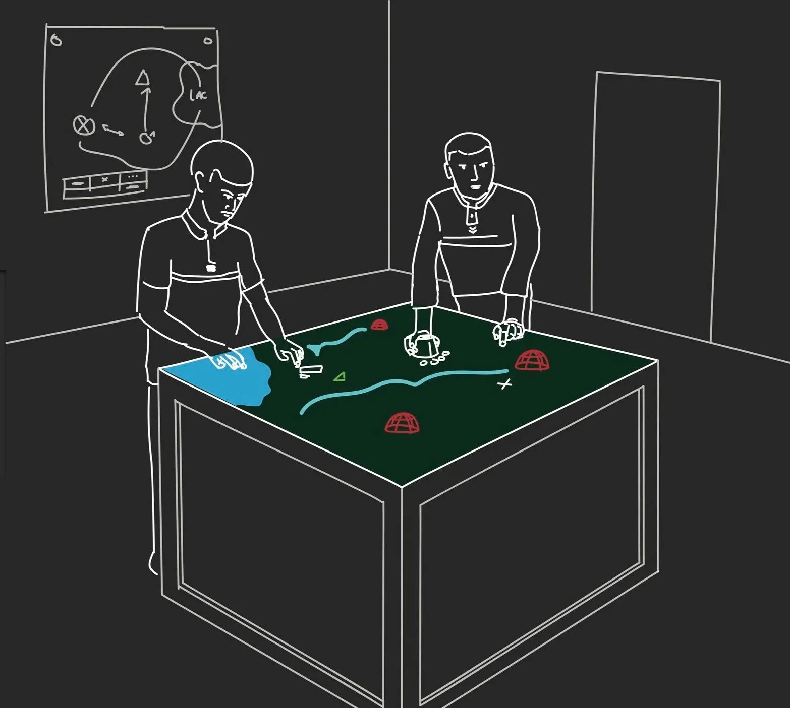
-
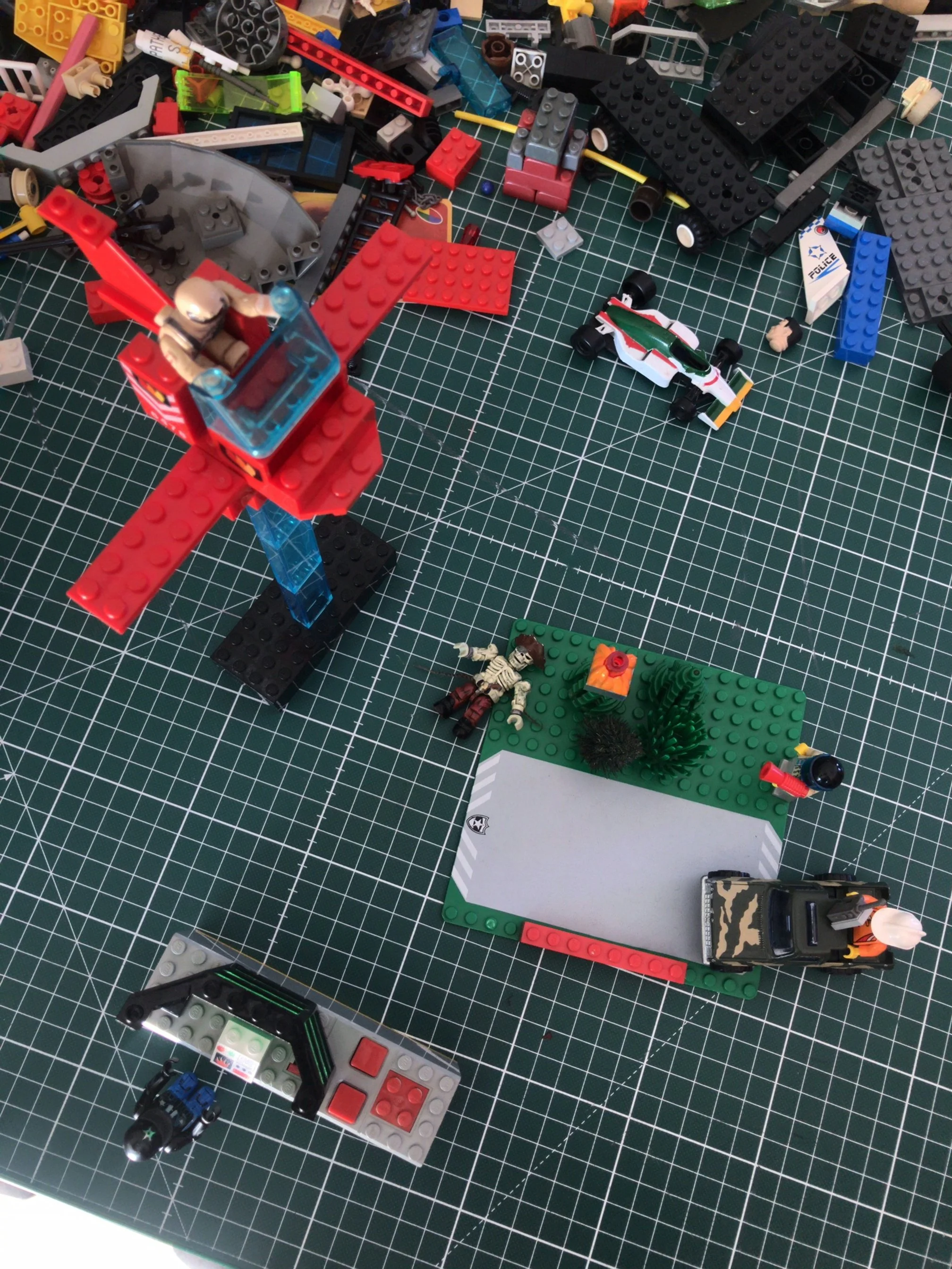
To collaboratively explore potential use cases and services, I facilitated a creative workshop using LEGO® bricks as a tangible prototyping tool.
This playful and accessible method enabled participants to:
Represent roles and tools in the firefighting ecosystem,
Simulate field operations, including coordination between air and ground units,
Externalize ideas in a way that encouraged discussion and storytelling.
By building scenarios with their hands, participants could express implicit knowledge and challenge early assumptions. This helped clarify user needs and refine design directions — especially regarding coordination, visibility, and stress conditions in mission contexts.
-
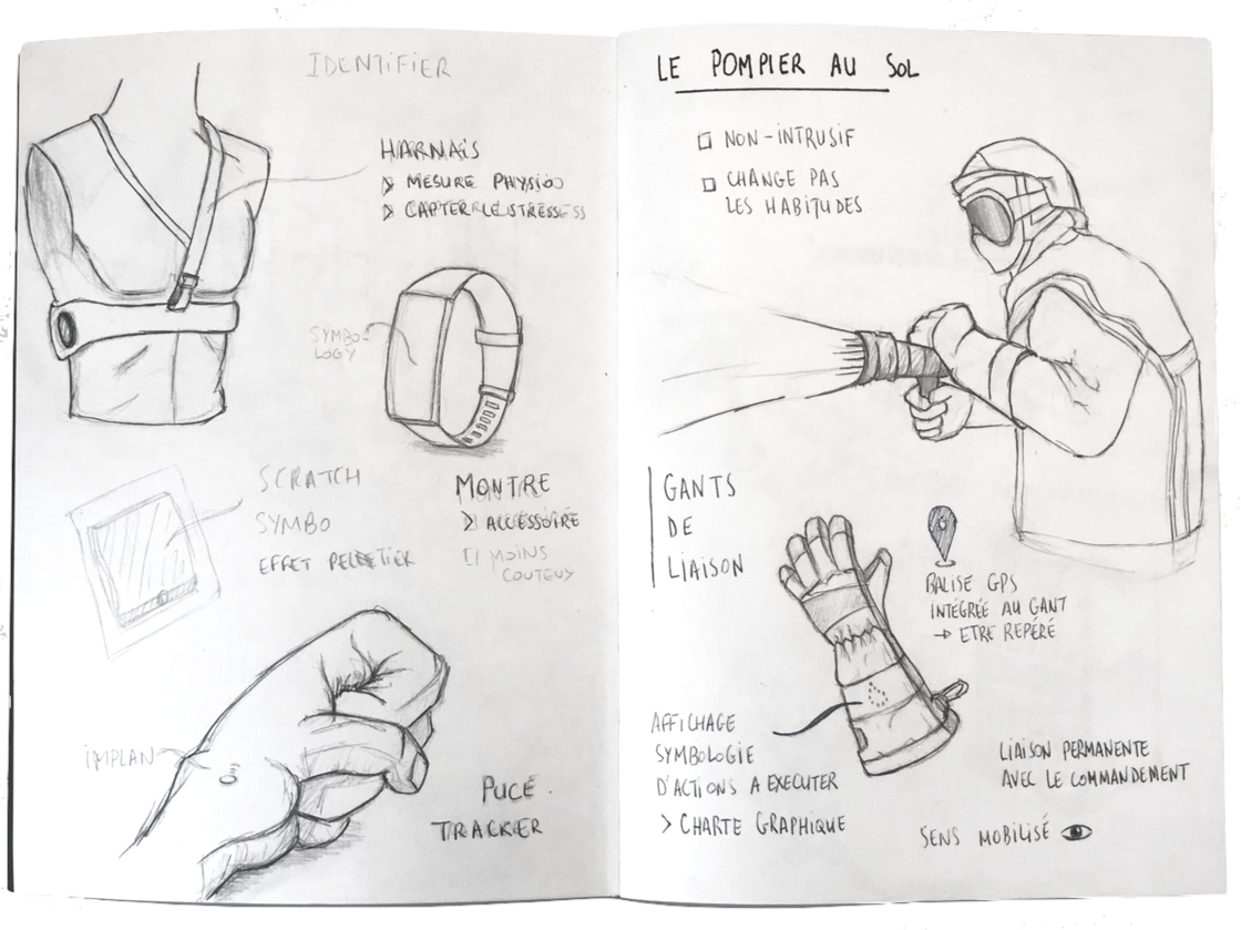
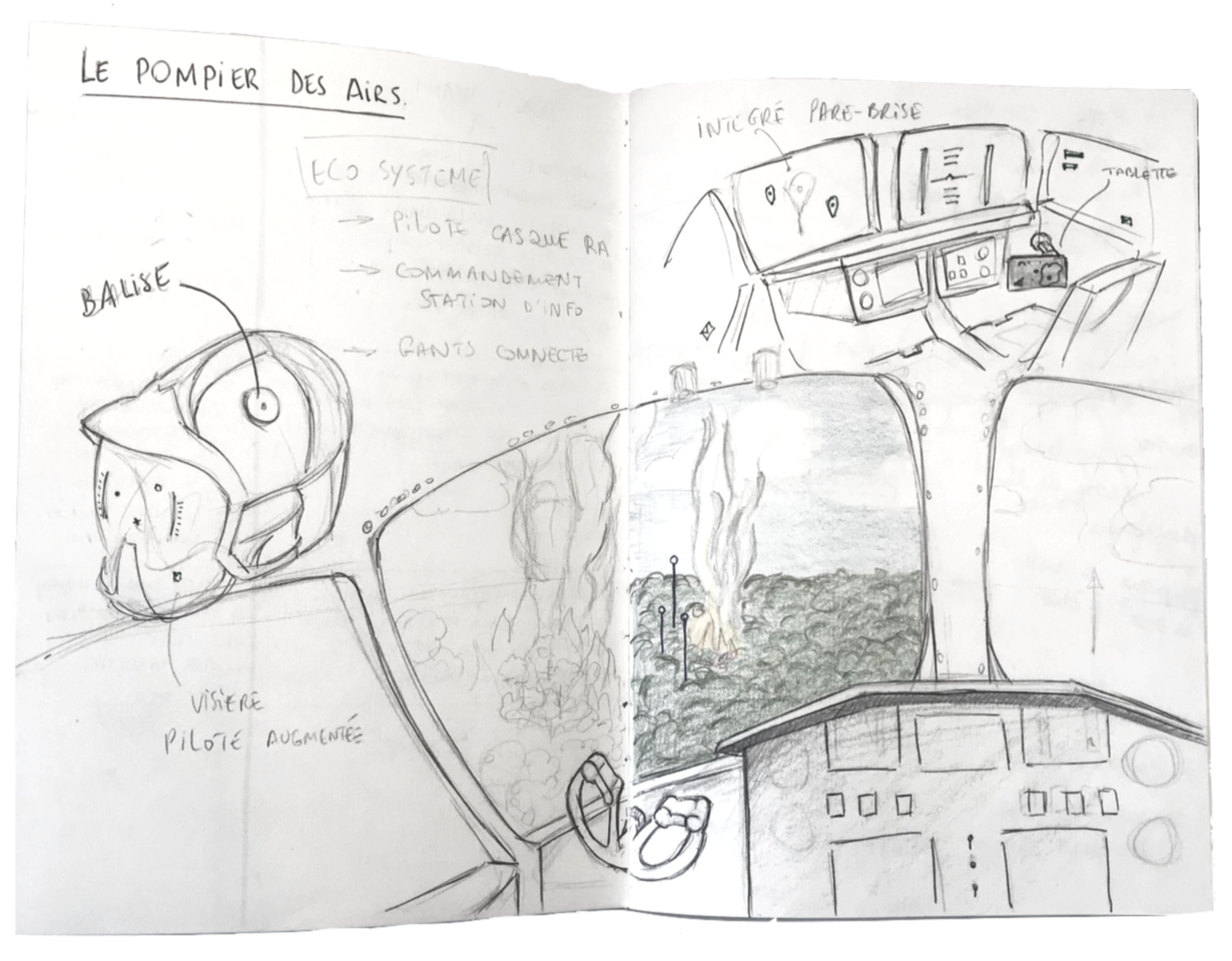
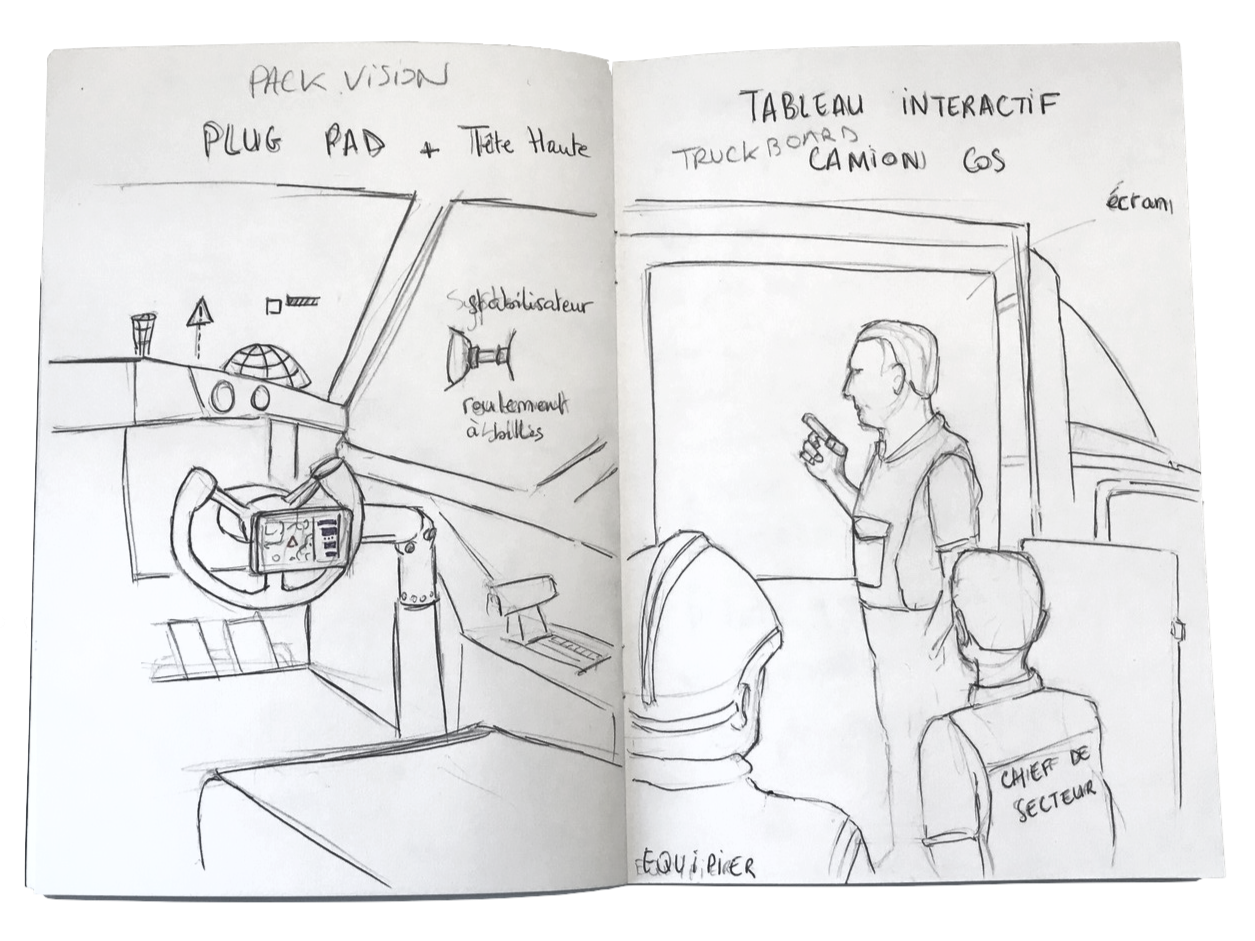
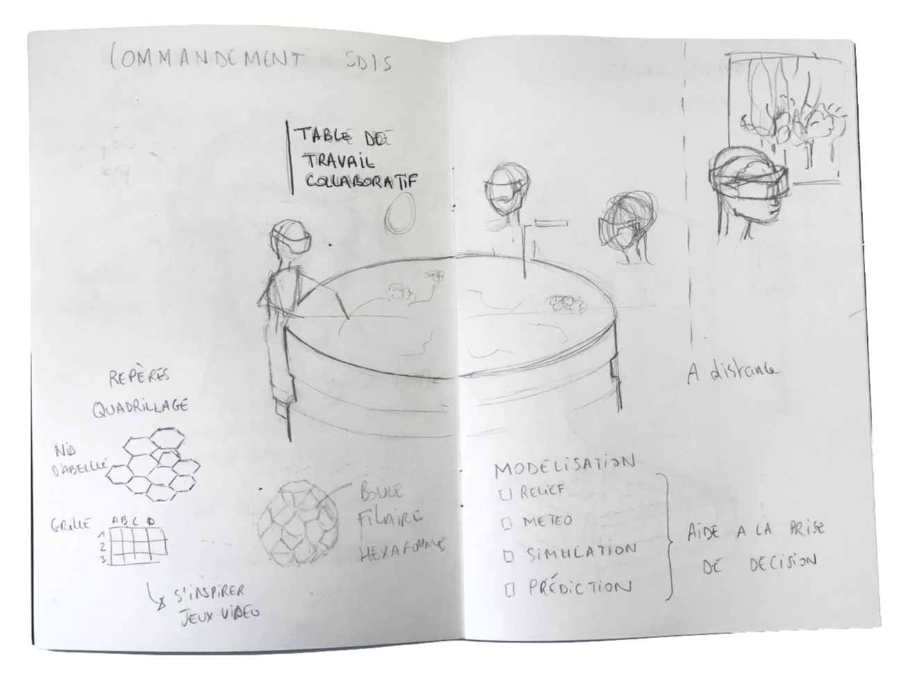
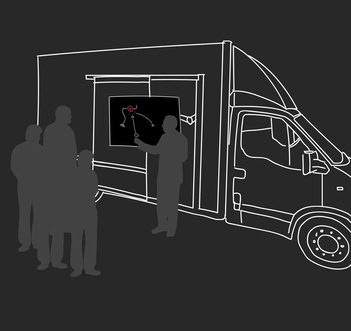
This phase aimed to translate field observations into preliminary concepts. By sketching out ideas directly after the research phase, I began exploring how technological enhancements could support firefighting operations — without disrupting current workflows.
Low-fidelity ideation helped test hypotheses from field insights and visualize interactions between digital tools and human actors.
Each drawing represents a concept or scenario developed to address pain points observed on-site: improving visibility and communication in cockpits, enhancing coordination tools for ground units, and designing ergonomic, non-intrusive equipment.
I focused on service and system design: not just creating devices, but imagining how data flows, alerts, and team dynamics could be improved throughout the firefighting ecosystem.
These early sketches became discussion tools with experts — fostering alignment and surfacing critical constraints before moving to higher-fidelity design.
-
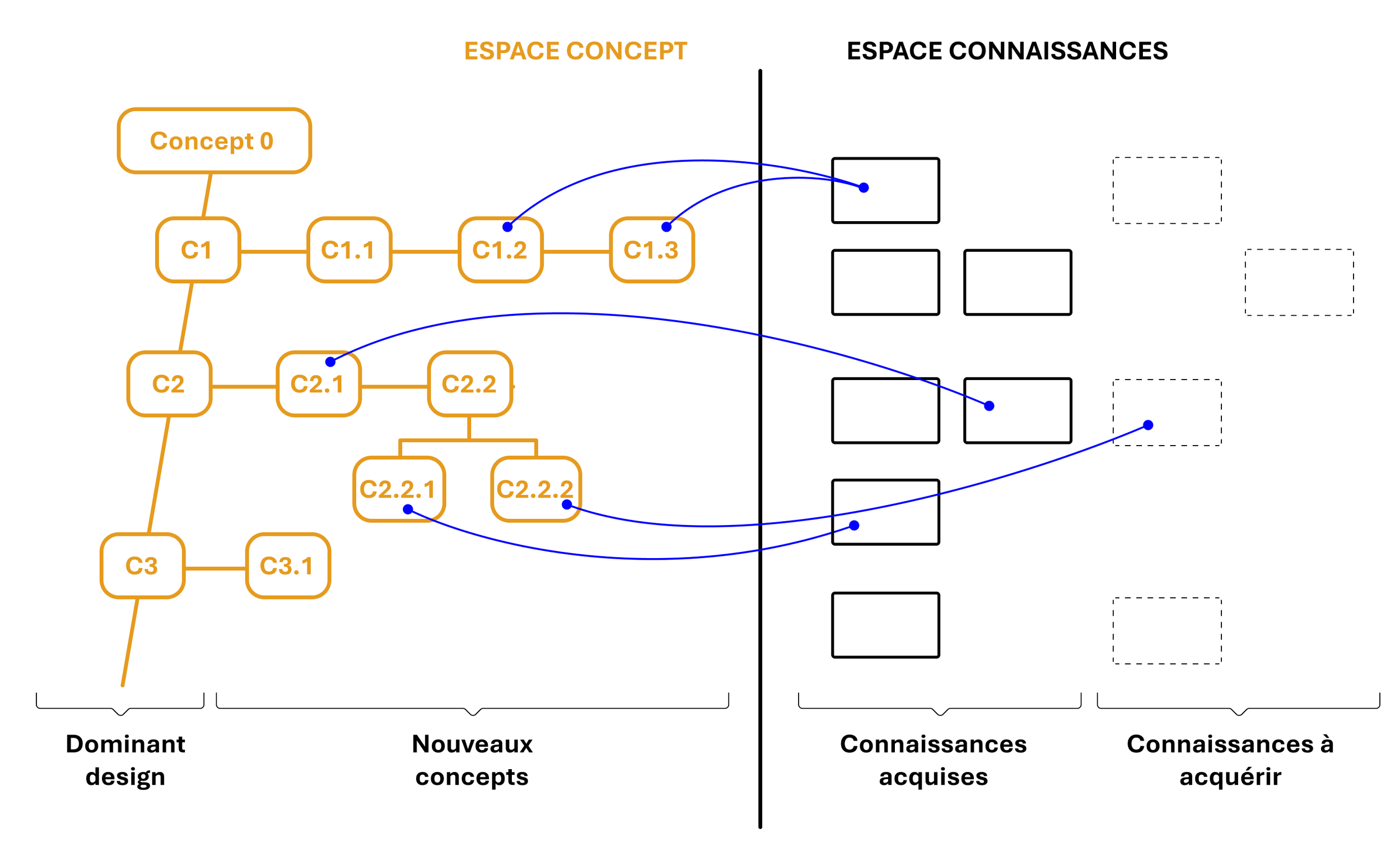
CK Theory (Concept–Knowledge Theory) is an innovation framework that separates what we know from what we can imagine so we can explore new product possibilities without being limited by existing assumptions.
The Knowledge space (K) contains all current facts, technologies, and constraints, while the Concept space (C) contains ideas that are desirable but not yet fully defined or feasible.
By alternating between expanding concepts and enriching knowledge, CK Theory helps teams structure creativity, uncover unexplored opportunities, and gradually transform bold ideas into viable, valuable product directions.
-
Description text goes here
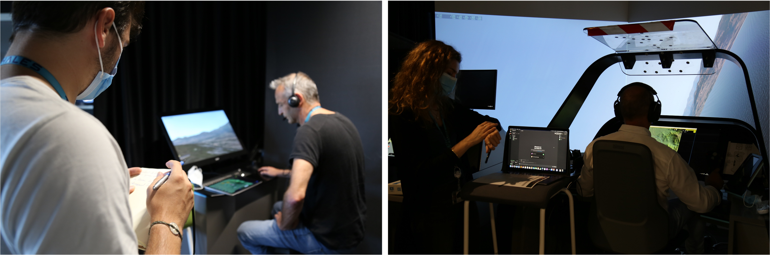
Phase 3: prototype, evaluate and iterate
Phase 3: prototype, evaluate and iterate
Prototype
Bring ideas to real
Evaluate

Test its value, performance, and market fit.